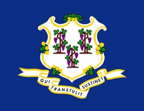
| CT State Facts |
|---|
 |
| Colony: Mar 3, 1636 |
| Statehood: Jan 9, 1788 |
| Counties: 8 |
| Borders: Massachusetts, New York and Rhode Island |
| CT Records |
|---|
| CT Land Ownership Maps |
| CT Maps & Atlases |
| CT Birth, Marriage & Deaths |
| CT Military Databases |
| CT Record Collections |
| CT Historical Newspapers |
| Create a Free Family Tree |
Today’s Connecticut counties did not always exist in the present form. They went through many different changes in the space of a few short years. Connecticut Counties were first formed while part of the Mississippi Territory, and after that the Connecticut Territory.
Connecticut Territorial Counties
The Connecticut Colony (aka Colony of Connecticut, Connecticut River Colony or River Colony), was established on March 3, 1636.
Two other English settlements were merged into the Colony of Connecticut:
- 1644 – Saybrook Colony
- 1662 – New Haven Colony
Fairfield, Hartford, New Haven and New London counties were created in 1666, after the Connecticut Colony and the New Haven Colony combined.
Windham and Litchfield Counties were created later in the colonial era, while Middlesex and Tolland Counties were created after American independence (both in 1785).
Connecticutwas one of the 13 original colonies. The State of Connecticut entered the union as the 5th state on January 9, 1788.
Connecticut Counties Today
Today, Connecticut is divided into 8 counties. States bordering Connecticut are Massachusetts, New York and Rhode Island.
there is no county government in Connecticut,
Although Connecticut is divided into counties, almost all functions of county government were abolished in 1960. The remaining county offices / departments were abolished by an act of the state legislature effective in December of 2000.
All local government consists solely on the municipality level.
The manes of Connecticut’s counties remain for geographical purposes only. Boundaries of the former CT counties are still used by the state to organize its judicial and state marshal system.
Connecticut’s court jurisdictions still adhere to the county boundaries, and Fairfield, Hartford and New Haven Counties have been further subdivided into several smaller jurisdictions.
Fun Facts about Connecticut Counties
Six of the counties are named for locations in England, where many early Connecticut settlers originated.
Counties by Year
- Fairfield, Hartford, New Haven and New London Counties was the original 4 counties created on May 10, 1866.
- Tolland County was the last county created on November 10, 1785.
County Size Facts
- Litchfield County (920 sq mi) is the largest county in Connecticut.
- Middlesex County (369 sq mi) is the smallest county in Connecticut.
County Population Facts
- Windham County (18,428) is the least populated county in Connecticut.
- Fairfield County (916,829) is the most populated county in Connecticut.
Connecticut City Facts
Connecticut’s 10 largest cities (2010) are:
- Bridgeport (144,229) is in Fairfield County
- New Haven (129,779) is in New Haven County
- Hartford (124,775) is in Hartford County
- Stamford (122,643) is in Fairfield County
- Waterbury (110,366) is in New Haven County
- Norwalk (85,603) is in Fairfield County
- Danbury (80,893) is in Fairfield County
- New Britain (71,254) is in Hartford County
- Bristol (61,353) is in Hartford County
- Meriden (59,653) is in New Haven County
Boundary Changes of Connecticut Counties from 1687 to 1960
This Interactive Map of Connecticut Counties show the historical boundaries, names, organization, and attachments of every county, extinct county and unsuccessful county proposal from 1687 to 1960.
List of Connecticut Counties
| County | Date Formed | Parent County | County Seat |
|---|---|---|---|
| Fairfield | 1666 | Original county created from Colonial Lands | Bridgeport |
| Hartford | 1666 | Original county created from Colonial Lands | Hartford |
| Litchfield | 1751 | Fairfield and Hartford counties | Litchfield |
| Middlesex | 1785 | Hartford and New London counties | Middletown |
| New Haven | 1666 | Original county created from Colonial Lands | New Haven |
| New London | 1666 | Original county created from Colonial Lands | New London |
| Tolland | 1786 | Hartford and Windham counties | Rockville |
| Windham | 1726 | Hartford and New London counties | Willimantic & Putnam |
List of Old Former / Extinct Connecticut Counties
There is one Connecticut county that was established and no longer exist. The below Connecticut counties no longer exist:
Westmoreland County, Connecticut
Created on October 10, 1776 from Litchfield County when Connecticut removed the town of Westmoreland from Litchfield County and made it “a distinct County” (the present day area of Wyoming Valley, Pennsylvania).
Westmoreland County was located entirely within Pennsylvania and a narrow strip of New York about 3 miles wide.
Much conflict with Pennsylvania resulted over the land claimed by Connecticut as Westmoreland County.
On December 30, 1782, a special a court of arbitration appointed by the Continental Congress met in Trenton, New Jersey, and rendered a unanimous decision in favor of Pennsylvania‘s claim.
Within a few weeks Pennsylvania was exercising full jurisdiction in the area. In return, Connecticut received a territory of 3,300,000 acres named the Western Reserve (in the future northeast of Ohio).
Afterwards, Pennsylvania refused to confirm the private land titles of the settlers. In response Westmoreland County briefly seceded to become the short-lived State of Westmoreland in 1784.
Connecticut finally ceded Westmoreland County it to Pennsylvania in 1786 after Pennsylvania confirmed the land titles and Westmoreland County was renamed to Luzerne County.
If any records from this time exist they may be found in Luzerne County, Pennsylvania